


The Science Behind Marine AI
We're building the future of marine intelligence by democratising access to sophisticated ocean AI models that transform complex marine data into actionable insights.
Our foundation model, DARWIN, transforms oceanographic data from a wide range of sources such as satellite, buoys, and models into complete, high-resolution marine map layers for users who make critical decisions about our oceans
Model Capabilities.
Classification
Automated classification of marine environmental states and oceanographic phenomena.
Enabling systematic pattern recognition across complex spatiotemporal datasets.
Regression
Quantitative prediction of continuous oceanographic variables.
Provides precise estimation of marine environmental parameters with high spatial fidelity.
Data Imputation
Intelligent gap-filling of incomplete marine observations.
Reconstructs missing oceanographic data through spatiotemporal modelling techniques.
Forecasting
Learning marine system dynamics.
Enables prediction of future ocean conditions and environmental state evolution.
Applications.
We deliver precise, timely intelligence for critical ocean-dependent decisions. From preventing marine disasters to optimising maritime operations, we turn the vast complexity of ocean data into clear, actionable guidance.

Marine Heatwave Outlooks
Our foundation model detects marine heat-wave precursors from subtle oceanographic patterns, providing early warnings that traditional temperature monitoring alone cannot capture.

Harmful Algae Bloom Forecasts
By identifying subtle patterns in water chemistry and temperature that precede toxic blooms, our model enables preventive action before stock losses occur.
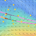
Vessel Route Optimisation
By providing refined marine environmental data for routing algorithms, our model helps bridge gaps in traditional meteorological forecasting for maritime operations.

Habitat & Species-Distribution
Our models integrates oceanographic conditions with sparse species observations, thereby predicting habitat suitability across unexplored marine areas.

Storm-Exposure Risk
Quantifying seasonal wave risk by learning from decades of ocean data, providing insurers with more accurate exposure assessments than traditional statistical models.

Oil-Spill / SAR Drift Forecasting
Our AI can predict oil spill trajectories by processing real-time ocean currents, focusing search and cleanup efforts more effectively.
Our Team.
Ocean OS was founded by engineers and scientists with direct experience in marine operations and oceanographic research. We are a team of physical oceanographers, geospatial data scientists, and machine learning engineers from Oxford, Cambridge, Google, and the University of Amsterdam. We are joined by scientific advisor Dr. Anthony Corbett from the Alan Turing Institute.

David Lamb, CEng
Co-CEO & Co-founder


Vincent Opitz
Co-CEO & Co-founder

Laurens Geffert, PhD
Head of Science

Kate Song, PhD
Computational Oceanographer

Coen van den Elsen
AI Research Engineer
Insights Feed.


